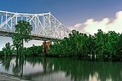
Baton Rouge, Louisiana
Baton Rouge ni msumba ukulu wa boma mu state ya Louisiana chalo cha United States.
Baton Rouge, Louisiana
Bâton-Rouge (French) | |||||
|---|---|---|---|---|---|
| City of Baton Rouge | |||||
| |||||
| Nicknames: Red Stick, The Capital City, B.R. | |||||
 Interactive map of Baton Rouge | |||||
| Coordinates: 30°26′51″N 91°10′43″W / 30.44750°N 91.17861°W | |||||
| Country | |||||
| State | |||||
| Parish | East Baton Rouge | ||||
| Founded | 1699 | ||||
| Settled | 1721 | ||||
| Incorporated | January 16, 1817 | ||||
| Government | |||||
| • Mayor-President | Sharon Weston Broome[1] (D) | ||||
| Area | |||||
| • State capital city and Consolidated city-parish | 88.52 sq mi (229.27 km2) | ||||
| • Land | 86.32 sq mi (223.56 km2) | ||||
| • Water | 2.20 sq mi (5.71 km2) | ||||
| • Total[note 1] | 79.11 sq mi (204.89 km2) | ||||
| Elevation | 56 ft (17 m) | ||||
| Population (2020) | |||||
| • State capital city and Consolidated city-parish | 227,470 | ||||
| • Rank | US: 99th | ||||
| • Density | 2,635.32/sq mi (1,017.50/km2) | ||||
| • Urban | 631,326 (US: 67th) | ||||
| • Urban density | 1,592.9/sq mi (615.0/km2) | ||||
| • Metro | 870,569 (US: 66th) | ||||
| Demonym | Baton Rougean | ||||
| Time zone | UTC−6 (CST) | ||||
| • Summer (DST) | UTC−5 (CDT) | ||||
| ZIP Codes | 70801–70817, 70819–70823, 70825–70827, 70831, 70833, 70835–70837, 70874, 70879, 70883, 70884, 70892–70896, 70898 | ||||
| Area code | 225 | ||||
| FIPS code | 22-05000 | ||||
| GNIS feature ID | 1629914 | ||||
| Interstate highways | |||||
| U.S. routes | |||||
| Website | www | ||||
Ukaboni
lemba- ↑ "Office of Mayor President". Baton Rouge Government Website. Archived from the original on January 7, 2017. Retrieved 3 January 2017.
- ↑ "2020 U.S. Gazetteer Files". United States Census Bureau. Retrieved March 20, 2022.
Longola ivyo vyabudika: <ref> tags exist for a group named "note", but no corresponding <references group="note"/> tag was found


