File:Africa relief location map.jpg

Saizi ya chakuona ichi: 635 × 600 pixels. Mu misani inyake: 254 × 240 pixels | 508 × 480 pixels | 813 × 768 pixels | 1,084 × 1,024 pixels | 1,525 × 1,440 pixels.
Chinthu cha kwenekuko (1,525 × 1,440 pixels, file size: 522 KB, MIME type: image/jpeg)

|
This map image could be re-created using vector graphics as an SVG file. This has several advantages; see Commons:Media for cleanup for more information. If an SVG form of this image is available, please upload it and afterwards replace this template with
{{vector version available|new image name}}.
It is recommended to name the SVG file “Africa relief location map.svg”—then the template Vector version available (or Vva) does not need the new image name parameter. |


Mwakudumula
| Malongosolelo |
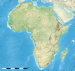
English: Blank physical map of political Africa, for geo-location purposes. Borders as in July 2011.
Français : Carte physique vierge de l'Afrique politique, destinée à la géolocalisation. Frontières telles qu'en juillet 2011. Lambert azimutal equal-area projection, WGS84 datum
|
||
| Siku | |||
| Ukaboni |
Based upon File:Africa_map_blank.svg created by myself
|
||
| Mlembi | Eric Gaba (Sting - fr:Sting) | ||
| Chilolezo (Kugwiliskaso ntchito ichi) |
|
||
| Other versions |
|


| Camera location | | View this and other nearby images on: OpenStreetMap |
|---|
Chilolezo
Eric Gaba, Wikimedia Commons user Sting, the copyright holder of this work, hereby publishes it under the following licenses:

|
Chilolezo ntchakupelekeka pakupanga copy, kutandazga panj kusintha na malango gha GNU Free Documentation License, Version 1.2 or any later version published by the Free Software Foundation; with no Invariant Sections, no Front-Cover Texts, and no Back-Cover Texts. A copy of the license is included in the section entitled GNU Free Documentation License. |
Chinthu ichi ntchakuzomelezgeka na Creative Commons Attribution-Share Alike 3.0 Unported license.
Attribution: Eric Gaba, Wikimedia Commons user Sting
- Ndimwe ŵakuzomelezgeka:
- kugaŵa – kuti mutandazge, kugaŵa na kusintha ntchito
- kusazga – kusintha chito iyi
- Pa malango ghakulondezga agha:
- Viyambilo vya kuchita – Mukwenela kupeleka malumbo ghawemi, kupeleka linki yakutyonda ku chilolezo, kweneso yowoyaniso pala vinyake vyasintha. Mukwenela kuchita nthena mwakwenelela, kwambula kujikhalila khonde.
- mwa kugaŵana – Pala mwasazga panji mwasintha chinthu, mukwenela kuchitandazga
You may select the license of your choice.
Mbili ya chinthu
Dofyani pa siku/nyengo kuti muone umo vikaonekela pa nyengo iyo.
| Siku/Nyengo | Kachithuzi | Vipimo | Mgwiliski | Ganizo | |
|---|---|---|---|---|---|
| sono | 12:27, 18 Julayi 2022 | | 1,525 × 1,440 (522 KB) | M.Bitton | Reverted to version as of 21:54, 5 May 2022 (UTC): per COM:OVERWRITE |
| 11:29, 18 Julayi 2022 |  | 1,627 × 1,536 (472 KB) | Jacob300 | Reverted to version as of 15:02, 5 May 2022 (UTC) | |
| 21:54, 5 Meyi 2022 |  | 1,525 × 1,440 (522 KB) | M.Bitton | Reverted to version as of 19:03, 14 July 2011 (UTC): per COM:OVERWRITE | |
| 15:02, 5 Meyi 2022 |  | 1,627 × 1,536 (472 KB) | Jacob300 | Reverted to version as of 17:16, 9 January 2022 (UTC) | |
| 18:23, 9 Janyuwale 2022 |  | 1,525 × 1,440 (522 KB) | M.Bitton | Reverted to version as of 19:03, 14 July 2011 (UTC): per COM:OVERWRITE | |
| 17:16, 9 Janyuwale 2022 |  | 1,627 × 1,536 (472 KB) | Jacob300 | Reverted to version as of 01:08, 19 October 2021 (UTC) | |
| 23:16, 19 Okutobala 2021 |  | 1,525 × 1,440 (522 KB) | M.Bitton | Reverted to version as of 19:03, 14 July 2011 (UTC): per COM:OVERWRITE | |
| 01:08, 19 Okutobala 2021 |  | 1,627 × 1,536 (472 KB) | Gebagebo | Added dotted line to indicate Somaliland | |
| 19:03, 14 Julayi 2011 |  | 1,525 × 1,440 (522 KB) | Sting | Sudan/South Sudan 07-2011 border update | |
| 13:31, 19 Julayi 2010 |  | 1,525 × 1,440 (424 KB) | Sting | Color profile |
Magwiliskilo ntchito
The following 4 pages use this file:
Umo chinthu chagwiliskikila ntchito
Ma wiki ghanyake agho ghakugwiliska ichi:
- Magwiliskilo pa als.wikipedia.org
- Magwiliskilo pa ar.wikipedia.org
- Magwiliskilo pa ast.wikipedia.org
- Magwiliskilo pa av.wikipedia.org
- Magwiliskilo pa azb.wikipedia.org
- قاهیره
- مانروویا
- داکار
- بیسائو
- کینشاسا
- آنتاناناریوو
- آکرا
- موشی (شهر)
- تانقا، تانزانیا
- عنابه
- لوساکا
- اقصر
- کاکامقا، کنیا
- الجزیره
- موروقورو
- هرجیسا
- نیامی
- تونس (شهر)
- وهران، الجزاییر
- العیون
- آبوجا
- کامپالا
- یائونده
- دارالسلام (تانزانیا)
- رباط (مراکش)
- لوآندا
- انجامنا
- موقادیشو
- لیبرویل
- دودوما
- باقامویو
- امتوارا
- لیندی
- سانقی
Wonani magwiliskilo ghanandi ghapa charu gha chinthu ichi.