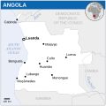
File:Angola - Location Map (2013) - AGO - UNOCHA.svg

Chinthu cha kwenekuko(SVG file, nominally 254 × 254 pixels, file size: 325 KB)

Render this image in .

Chinthu ichi ntchaku Wikimedia Commons ndipo chingagwiliskikaso kunyake. Vakulongosola vake file description page vili pasi apa.

Mwakudumula

Malongosolelo
English: Locator map of Angola.
Siku
Ukaboni
English: Angola Locator Map (ReliefWeb), ESRI, UNCS, Natural Earth
Mlembi
SVG genesis
InfoField
 
The SVG code is valid.
 
This map was created with Inkscape.
 
 This map uses embedded text that can be easily translated using a text editor.


Chilolezo

w:en:Creative Commons
Viyambilo vya kuchita
This file is licensed under the Creative Commons Attribution 3.0 Unported license.
Attribution: OCHA
Ndimwe ŵakuzomelezgeka:
  • kugaŵa – kuti mutandazge, kugaŵa na kusintha ntchito
  • kusazga – kusintha chito iyi
Pa malango ghakulondezga agha:
  • Viyambilo vya kuchita – Mukwenela kupeleka malumbo ghawemi, kupeleka linki yakutyonda ku chilolezo, kweneso yowoyaniso pala vinyake vyasintha. Mukwenela kuchita nthena mwakwenelela, kwambula kujikhalila khonde.
This map is part of a collection of 216 free country maps, created by the UN Office for the Coordination of Humanitarian Affairs (OCHA), to be used in print, web or broadcast products.

The ReliefWeb Location Maps released here are maps that highlight a country, its capital, major populated places and the surrounding regions.

Attribution Requirements

Using the map without modifications: ensure that the sources and the disclaimer are below the map. Credit as follows: "Credit: OCHA".

For use with alteration: remove the OCHA logo and disclaimer following any modification to the map, but keep the data sources as mentioned below the map. Credit the modified map as follows: "Based on OCHA map". You are responsible for the content of your map.

We are keen to receive your feedback and hear how you used OCHA's maps. We would be grateful if you would notify us by e-mail and share your work with us.

UN Disclaimer
The designations employed and the presentation of material of this map do not imply the expression of any opinion whatsoever on the part of the Secretariat of the United Nations concerning the legal status of any country, territory, city or area or of its authorities or concerning the delimitation of its frontiers or boundaries.
VRT Wikimedia

This work is free and may be used by anyone for any purpose. If you wish to use this content, you do not need to request permission as long as you follow any licensing requirements mentioned on this page.

The Wikimedia Foundation has received an e-mail confirming that the copyright holder has approved publication under the terms mentioned on this page. This correspondence has been reviewed by a Volunteer Response Team (VRT) member and stored in our permission archive. The correspondence is available to trusted volunteers as ticket #2014031410007248.

If you have questions about the archived correspondence, please use the VRT noticeboard. Ticket link: https://ticket.wikimedia.org/otrs/index.pl?Action=AgentTicketZoom&TicketNumber=2014031410007248
Find other files from the same ticket: SDC query (SPARQL)

Captions

Add a one-line explanation of what this file represents

Items portrayed in this file

depicts English

copyrighted English

inception English

2013

MIME type English

image/svg+xml

checksum English

400c9c12aba3fd8b54b959e1deb8e445a8d4f24e

determination method English: SHA-1 English

data size English

332,380 byte

height English

254 pixel

width English

254 pixel

Mbili ya chinthu

Dofyani pa siku/nyengo kuti muone umo vikaonekela pa nyengo iyo.

(newest | oldest) Wonani (newer 10 | ) (10 | 20 | 50 | 100 | 250 | 500)
Siku/NyengoKachithuziVipimoMgwiliskiGanizo
sono04:08, 19 Novembala 2022Kachithuzi kachoko nga mpha 04:08, 19 Novembala 2022254 × 254 (325 KB)Pengetik-AMFile uploaded using svgtranslate tool (https://svgtranslate.toolforge.org/). Added translation for id.
16:12, 1 Malichi 2021Kachithuzi kachoko nga mpha 16:12, 1 Malichi 2021254 × 254 (324 KB)Trần Nguyễn Minh HuyFile uploaded using svgtranslate tool (https://svgtranslate.toolforge.org/). Added translation for vi.
16:04, 1 Malichi 2021Kachithuzi kachoko nga mpha 16:04, 1 Malichi 2021254 × 254 (324 KB)Trần Nguyễn Minh HuyFile uploaded using svgtranslate tool (https://svgtranslate.toolforge.org/). Added translation for vi.
17:43, 21 Ogasiti 2019Kachithuzi kachoko nga mpha 17:43, 21 Ogasiti 2019254 × 254 (323 KB)TrinalivNamibe→Moçâmedes e Kuito→Cuíto.
17:38, 21 Ogasiti 2019Kachithuzi kachoko nga mpha 17:38, 21 Ogasiti 2019254 × 254 (305 KB)TrinalivReverted to version as of 15:51, 30 October 2014 (UTC)
17:24, 21 Ogasiti 2019Kachithuzi kachoko nga mpha 17:24, 21 Ogasiti 2019254 × 254 (323 KB)TrinalivNamibe→Moçâmedes e Kuito→Cuíto.
15:51, 30 Okutobala 2014Kachithuzi kachoko nga mpha 15:51, 30 Okutobala 2014254 × 254 (305 KB)Dyln1Removed watermark.
20:33, 24 Febuluwale 2014Kachithuzi kachoko nga mpha 20:33, 24 Febuluwale 2014254 × 254 (349 KB)Jeremybxslt v2b
04:41, 10 Febuluwale 2014Kachithuzi kachoko nga mpha 04:41, 10 Febuluwale 2014250 × 250 (1.17 MB)Pharosremove whitespace + text
21:46, 19 Disembala 2013Kachithuzi kachoko nga mpha 21:46, 19 Disembala 2013254 × 267 (1.11 MB)GChrissExperimental new version w/ outlined text used for river names
(newest | oldest) Wonani (newer 10 | ) (10 | 20 | 50 | 100 | 250 | 500)

The following page uses this file:

Umo chinthu chagwiliskikila ntchito

Ma wiki ghanyake agho ghakugwiliska ichi:

Metadata