File:Azerbaijan (orthographic projection).svg

Size of this PNG preview of this SVG file: 551 × 551 pixels. Mu misani inyake: 240 × 240 pixels | 480 × 480 pixels | 768 × 768 pixels | 1,024 × 1,024 pixels | 2,048 × 2,048 pixels.
Chinthu cha kwenekuko (SVG file, nominally 551 × 551 pixels, file size: 570 KB)
Mwakudumula
| Malongosolelo |
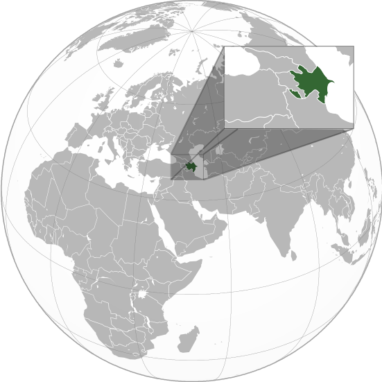
English: Orthographic Projection Map of Azerbaijan.
The other orthographic projection maps. .svg) |
| Siku | |
| Ukaboni | Chinthu chane |
| Mlembi | en:User:Night w |
.svg)
.svg)
.svg)
.svg)
.svg)
.svg)
.svg)
.svg)
.svg)
.svg)
.svg)
.svg)
.svg)
.svg)
.svg)
.svg)
.svg)
.svg)
.svg)
.svg)
.svg)
.svg)
.svg)
.svg)
.svg)
.svg)
.svg)
.svg)
.svg)
.svg)
.svg)
.svg)
.svg)
.svg)
.svg)
.svg)
.svg)
.svg)
.svg)
.svg)
.svg)
.svg)
.svg)
.svg)
.svg)
.svg)
.svg)
.svg)
.svg)
.svg)
.svg)
.svg)
.svg)
.svg)
.svg)
.svg)
.svg)
.svg)
.svg)
.svg)
.svg)
.svg)
.svg)
.svg)
.svg)
.svg)
.svg)
.svg)
.svg)
.svg)
.svg)
.svg)
.svg)

.svg)

.svg)

.svg)
.svg)
.svg)
.svg)
.svg)
.svg)
.svg)


.svg)
.svg)
.svg)
.svg)
.svg)
.svg)
.svg)

.svg)
.svg)
.svg)
.svg)
.svg)
.svg)
.svg)
.svg)
.svg)

.svg)
.svg)
.svg)
.svg)
.svg)
.svg)
.svg)
_without_national_boundaries.svg)
.svg)
.svg)
.svg)
.svg)
.svg)
.svg)

.svg)
.svg)
.png)
.svg)
.svg)
.svg)
.svg)

.svg)
.svg)
.svg)
.svg)
.svg)
.svg)
.svg)
.svg)
.svg)
.svg)
.svg)

.svg)
.svg)
.svg)
.svg)
.svg)
.svg)
.svg)
.svg)
.svg)

.svg)
.svg)

.svg)
.svg)
.svg)
.svg)
.svg)
.svg)
.svg)
.svg)
.svg)
.svg)
.svg)
.svg)
.svg)
.svg)
.svg)
.svg)
.svg)
.svg)
.svg)
.svg)
.svg)
.svg)
.svg)
.svg)
.svg)
.svg)
.svg)
_-_Crimea_disputed.svg)
.svg)
.svg)
.svg)
.svg)
.svg)
.svg)
.svg)
.svg)
.svg)
.svg)
.svg)
_political.svg)
.svg)
.svg)
.svg)
.svg)
_-_Crimea_disputed_-_no_borders.svg)
.svg)
.svg)
.svg)
.svg)
.svg)
.svg)
.svg)
.svg)
.svg)
.svg)
.svg)

.svg)
.svg)
.svg)

.png)
.svg)
.svg)
.svg)
.svg)
.svg)
.svg)
.svg)
.svg)
.svg)
.svg)
.svg)
.svg)
.svg)
.svg)
.svg)
.svg)
.svg)
.svg)
.svg)
.svg)
.svg)
.svg)
.svg)
.svg)
.svg)
.svg)
.svg)
.svg)
.svg)
.svg)
.svg)
.svg)
.svg)
.svg)
.png)
.svg)
.svg)
.svg)
_(orthographic_projection).png)
.svg)
Chilolezo
I, the copyright holder of this work, hereby publish it under the following licenses:

|
Chilolezo ntchakupelekeka pakupanga copy, kutandazga panj kusintha na malango gha GNU Free Documentation License, Version 1.2 or any later version published by the Free Software Foundation; with no Invariant Sections, no Front-Cover Texts, and no Back-Cover Texts. A copy of the license is included in the section entitled GNU Free Documentation License. |
Chinthu ichi ntchakuzomelezgeka na Creative Commons Attribution-Share Alike 3.0 Unported license.
- Ndimwe ŵakuzomelezgeka:
- kugaŵa – kuti mutandazge, kugaŵa na kusintha ntchito
- kusazga – kusintha chito iyi
- Pa malango ghakulondezga agha:
- Viyambilo vya kuchita – Mukwenela kupeleka malumbo ghawemi, kupeleka linki yakutyonda ku chilolezo, kweneso yowoyaniso pala vinyake vyasintha. Mukwenela kuchita nthena mwakwenelela, kwambula kujikhalila khonde.
- mwa kugaŵana – Pala mwasazga panji mwasintha chinthu, mukwenela kuchitandazga
You may select the license of your choice.
Original upload log
The original description page was on en.wikipedia (file log). All following user names refer to en.wikipedia.
.svg)
- 23:49, 20 April 2011 (UTC) Sisyphos23 551×551 (557 KB)
- 14:15, 15 April 2011 (UTC) Chipmunkdavis 551×551 (568 KB) (Sharpening smaller image)
- 09:57, 15 April 2011 (UTC) Dbachmann 551×551 (577 KB) (suggestion)
- 23:05, 14 April 2011 (UTC) Night w 551×551 (571 KB) (trying to colour)
- 22:58, 14 April 2011 (UTC) Night w 551×551 (575 KB) ({{Information |Description={{en|1=Azerbaijan}} |Source=Own work |Author=Night w |Date=2011-04 |Permission= |other_versions={{User:Ssolbergj/orthographic}} }} == {{int:license}} == {{self|cc-by-sa-3.0|GFDL|migration=redundant}} {{ImageNot)
Mbili ya chinthu
Dofyani pa siku/nyengo kuti muone umo vikaonekela pa nyengo iyo.
.svg&dir=prev)
.svg&offset=20160827021508)
.svg&offset=&limit=20)
.svg&offset=&limit=50)
.svg&offset=&limit=100)
.svg&offset=&limit=250)
.svg&offset=&limit=500)
| Siku/Nyengo | Kachithuzi | Vipimo | Mgwiliski | Ganizo | |
|---|---|---|---|---|---|
| sono | 01:36, 23 Malichi 2023 | | 551 × 551 (570 KB) | M.Bitton | Reverted to version as of 09:05, 14 September 2022 (UTC): per COM:OVERWRITE |
| 13:56, 22 Malichi 2023 |  | 689 × 689 (445 KB) | Multituberculata | ||
| 23:29, 16 Sekutembala 2022 |  | 551 × 551 (570 KB) | M.Bitton | Reverted to version as of 09:05, 14 September 2022 (UTC): per COM:OVERWRITE | |
| 21:54, 16 Sekutembala 2022 |  | 689 × 689 (445 KB) | Hogweard | Issues fixed - and South Sudan border added | |
| 09:05, 14 Sekutembala 2022 |  | 551 × 551 (570 KB) | Toghrul R | Reverted to version as of 15:45, 29 August 2016 (UTC) the Middle East region and Europe were broken, reverting to the previous version without South Sudan; waiting for the fix | |
| 18:00, 13 Disembala 2019 |  | 551 × 551 (421 KB) | Goran tek-en | Added border for South Sudan as requested by {{u|Maphobbyist}} | |
| 15:45, 29 Ogasiti 2016 |  | 551 × 551 (570 KB) | Artoxx | Reverted to version as of 15:31, 19 April 2016 (UTC) | |
| 15:44, 29 Ogasiti 2016 |  | 551 × 551 (190 KB) | Artoxx | Reverted to version as of 02:15, 27 August 2016 (UTC) | |
| 02:16, 27 Ogasiti 2016 |  | 551 × 551 (190 KB) | MosMusy | Georgia and Moldova have their main maps with territories not under control shaded. | |
| 02:15, 27 Ogasiti 2016 |  | 551 × 551 (190 KB) | MosMusy | Moldova and Georgia's map all have shading for territory not under their government's control. |
Magwiliskilo ntchito
The following page uses this file:
Umo chinthu chagwiliskikila ntchito
Ma wiki ghanyake agho ghakugwiliska ichi:
- Magwiliskilo pa af.wikipedia.org
- Magwiliskilo pa ami.wikipedia.org
- Magwiliskilo pa arc.wikipedia.org
- Magwiliskilo pa ar.wikipedia.org
- قائمة الدول ذات السيادة والأقاليم التابعة في آسيا
- مستخدم:جار الله/قائمة صور مقالات العلاقات الثنائية
- العلاقات الأذربيجانية الأمريكية
- العلاقات الأذربيجانية الأنغولية
- العلاقات الأذربيجانية الكورية الجنوبية
- العلاقات الأذربيجانية الإريترية
- العلاقات الأذربيجانية السويسرية
- العلاقات الأذربيجانية الألمانية
- العلاقات الأذربيجانية الليختنشتانية
- العلاقات الأذربيجانية البوليفية
- العلاقات الأذربيجانية الموزمبيقية
- العلاقات الأذربيجانية الألبانية
- العلاقات الأذربيجانية البلجيكية
- العلاقات الأذربيجانية الإثيوبية
- العلاقات الأذربيجانية البيلاروسية
- العلاقات الأذربيجانية الطاجيكستانية
- العلاقات الأذربيجانية الرومانية
- العلاقات الأذربيجانية الأرجنتينية
- العلاقات الأذربيجانية الغامبية
- العلاقات الأذربيجانية القبرصية
- العلاقات الأذربيجانية السيراليونية
- العلاقات الأذربيجانية النيبالية
- العلاقات الأذربيجانية الليبيرية
- العلاقات الأذربيجانية التشيكية
- العلاقات الأذربيجانية الميانمارية
- العلاقات الأذربيجانية الكندية
- العلاقات الأذربيجانية الزيمبابوية
- العلاقات الأذربيجانية البالاوية
- العلاقات الأذربيجانية النيجيرية
- العلاقات الأذربيجانية اليمنية
- العلاقات الأذربيجانية الفانواتية
- العلاقات الأذربيجانية الغابونية
- العلاقات الأذربيجانية البنمية
- العلاقات الأذربيجانية الكوبية
- العلاقات الأذربيجانية الجورجية
- العلاقات الأذربيجانية التونسية
- العلاقات الأذربيجانية الكورية الشمالية
- العلاقات الأذربيجانية الهندية
- العلاقات الأذربيجانية اليابانية
- العلاقات الأذربيجانية الإيطالية
- العلاقات الأذربيجانية الناوروية
- العلاقات الأذربيجانية الأسترالية
- العلاقات الأذربيجانية الزامبية
- العلاقات الأذربيجانية الفيجية
- العلاقات الأذربيجانية المارشالية
- العلاقات الأذربيجانية المالية
Wonani magwiliskilo ghanandi ghapa charu gha chinthu ichi.
.svg)
.svg)