File:HND orthographic.svg

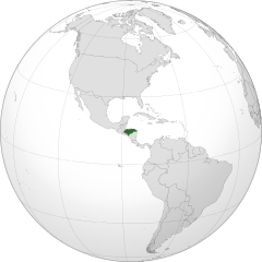
Size of this PNG preview of this SVG file: 550 × 550 pixels. Mu misani inyake: 240 × 240 pixels | 480 × 480 pixels | 768 × 768 pixels | 1,024 × 1,024 pixels | 2,048 × 2,048 pixels.
Chinthu cha kwenekuko (SVG file, nominally 550 × 550 pixels, file size: 1.09 MB)
Mwakudumula
| Malongosolelo |
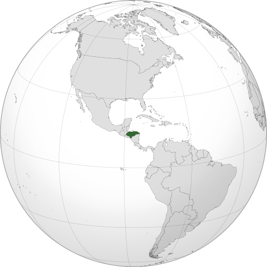
English: Orthographic map of Honduras centered at 15° N, 86° W.
Official territory.
Claimed territories. |
| Siku | |
| Ukaboni |
Chinthu chane with Natural Earth Data This W3C-unspecified vector image was created with Inkscape . |
| Mlembi | Addicted04 |
Chilolezo
I, the copyright holder of this work, hereby publish it under the following license:
Chinthu ichi ntchakuzomelezgeka na Creative Commons Attribution-Share Alike 3.0 Unported license.
- Ndimwe ŵakuzomelezgeka:
- kugaŵa – kuti mutandazge, kugaŵa na kusintha ntchito
- kusazga – kusintha chito iyi
- Pa malango ghakulondezga agha:
- Viyambilo vya kuchita – Mukwenela kupeleka malumbo ghawemi, kupeleka linki yakutyonda ku chilolezo, kweneso yowoyaniso pala vinyake vyasintha. Mukwenela kuchita nthena mwakwenelela, kwambula kujikhalila khonde.
- mwa kugaŵana – Pala mwasazga panji mwasintha chinthu, mukwenela kuchitandazga
Mbili ya chinthu
Dofyani pa siku/nyengo kuti muone umo vikaonekela pa nyengo iyo.
| Siku/Nyengo | Kachithuzi | Vipimo | Mgwiliski | Ganizo | |
|---|---|---|---|---|---|
| sono | 23:01, 8 Disembala 2011 | | 550 × 550 (1.09 MB) | Addicted04 |
Magwiliskilo ntchito
The following page uses this file:
Umo chinthu chagwiliskikila ntchito
Ma wiki ghanyake agho ghakugwiliska ichi:
- Magwiliskilo pa avk.wikipedia.org
- Magwiliskilo pa bg.wikipedia.org
- Magwiliskilo pa bi.wikipedia.org
- Magwiliskilo pa ceb.wikipedia.org
- Magwiliskilo pa de.wikipedia.org
- Magwiliskilo pa en.wikipedia.org
- Magwiliskilo pa es.wikipedia.org
- Honduras
- Usuario Discusión:Jcsanchez1
- Usuario discusión:Ruben bardales85
- Wikiproyecto:Honduras
- Usuario discusión:GiovanniB374
- Usuario:Addicted04/Archivo de discusión 01
- Usuario Discusión:RubiksMaster110
- Usuario Discusión:Historiador99
- Usuario discusión:Katuketi
- Portal:Honduras/Introducción
- Portal:Honduras
- Wikiproyecto:Honduras/Bienvenida
- Usuario:Santi Chuco/Agenda4
- Usuario discusión:Jmschon
- Wikiproyecto:Ilustración/Taller de Cartografía/Realizaciones/Mapas ortográficos/América del Norte
- Diversidad sexual en Honduras
- Dictaduras en Honduras
- Magwiliskilo pa fi.wikipedia.org
- Magwiliskilo pa he.wikipedia.org
- Magwiliskilo pa ia.wikipedia.org
- Magwiliskilo pa id.wikibooks.org
- Magwiliskilo pa ie.wikipedia.org
- Magwiliskilo pa ilo.wikipedia.org
- Magwiliskilo pa incubator.wikimedia.org
- Magwiliskilo pa ko.wikipedia.org
- Magwiliskilo pa lad.wikipedia.org
- Magwiliskilo pa lfn.wikipedia.org
- Magwiliskilo pa lo.wikipedia.org
- Magwiliskilo pa mg.wikipedia.org
- Magwiliskilo pa mn.wikipedia.org
- Magwiliskilo pa mt.wikipedia.org
- Magwiliskilo pa mwl.wikipedia.org
- Magwiliskilo pa mzn.wikipedia.org
- Magwiliskilo pa pl.wikipedia.org
- Magwiliskilo pa ru.wikipedia.org
Wonani magwiliskilo ghanandi ghapa charu gha chinthu ichi.