Chinthu ichi ntchaku Wikimedia Commons ndipo chingagwiliskikaso kunyake.
Vakulongosola vake file description page vili pasi apa.
Mwakudumula
Chilolezo
I, the copyright holder of this work, hereby publish it under the following licenses:
Chilolezo ntchakupelekeka pakupanga copy, kutandazga panj kusintha na malango gha GNU Free Documentation License Free Software Foundation ; with no Invariant Sections, no Front-Cover Texts, and no Back-Cover Texts. A copy of the license is included in the section entitled GNU Free Documentation License http://www.gnu.org/copyleft/fdl.html GFDL GNU Free Documentation License true true
Ndimwe ŵakuzomelezgeka:
kugaŵa – kuti mutandazge, kugaŵa na kusintha ntchitokusazga – kusintha chito iyi
Pa malango ghakulondezga agha:
Viyambilo vya kuchita – Mukwenela kupeleka malumbo ghawemi, kupeleka linki yakutyonda ku chilolezo, kweneso yowoyaniso pala vinyake vyasintha. Mukwenela kuchita nthena mwakwenelela, kwambula kujikhalila khonde.mwa kugaŵana – Pala mwasazga panji mwasintha chinthu, mukwenela kuchitandazga
na dango la
same or compatible license nga ntchiphya.
https://creativecommons.org/licenses/by-sa/4.0 CC BY-SA 4.0 Creative Commons Attribution-Share Alike 4.0 true true Mungasankha chizomelezgo icho mwakhumba.
chiTumbuka Add a one-line explanation of what this file represents
Mbili ya chinthu
Dofyani pa siku/nyengo kuti muone umo vikaonekela pa nyengo iyo.
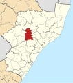
Siku/Nyengo Kachithuzi Vipimo Mgwiliski Ganizo sono 22:33, 13 Meyi 2011 712 × 805 (499 KB) Htonl == Summary == {{Information |Description ={{en|1=Map of municipal boundaries in w:KwaZulu-Natal , as they will be after the municipal elections of 18 May 2011 , with the w:Msinga Local Municipality h
Magwiliskilo ntchito
The following page uses this file:
Umo chinthu chagwiliskikila ntchito
Ma wiki ghanyake agho ghakugwiliska ichi:
Magwiliskilo pa af.wikipedia.org
Magwiliskilo pa en.wikipedia.org
Magwiliskilo pa ha.wikipedia.org
Magwiliskilo pa ig.wikipedia.org
Magwiliskilo pa nso.wikipedia.org
Magwiliskilo pa pl.wikipedia.org
Magwiliskilo pa sw.wikipedia.org
Magwiliskilo pa ts.wikipedia.org
Magwiliskilo pa www.wikidata.org
Magwiliskilo pa yo.wikipedia.org
Magwiliskilo pa zu.wikipedia.org
Chinthu ichi china vyakulemba vinyake ivo panji vikasazgika pa siku ilo kamela ikajambulilanga, panji apo makina gha ghakulemba ghakajambulila.
Pala chinthu chakwamba chasinthika, vyakulemba vinandi vikuukako.


