File:Mongolia (orthographic projection).svg

Size of this PNG preview of this SVG file: 553 × 553 pixels. Mu misani inyake: 240 × 240 pixels | 480 × 480 pixels | 768 × 768 pixels | 1,024 × 1,024 pixels | 2,048 × 2,048 pixels.
Chinthu cha kwenekuko (SVG file, nominally 553 × 553 pixels, file size: 301 KB)
Mwakudumula
| Malongosolelo |
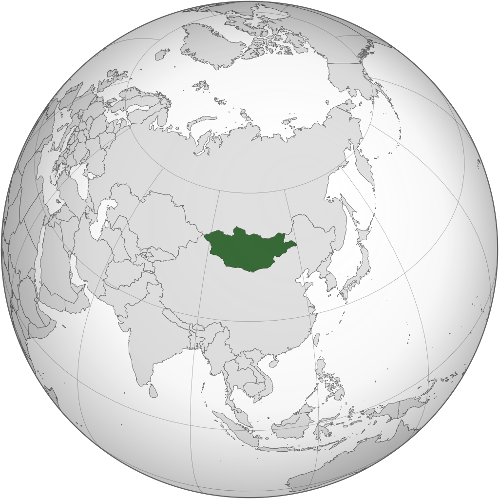
English: Orthographic Projection of Mongolia |
||
| Ukaboni | Chinthu chane | ||
| Mlembi | ASDFGHJ | ||
| Other versions |
.svg)
|
.svg)
.svg)
.svg)
.svg)
.svg)
.svg)
.svg)
.svg)
.svg)
.svg)
.svg)
.svg)
.svg)
.svg)
.svg)
.svg)
.svg)
.svg)
.svg)
.svg)
.svg)
.svg)
.svg)
.svg)
.svg)
.svg)
.svg)
.svg)
.svg)
.svg)
.svg)
.svg)
.svg)
.svg)
.svg)
.svg)
.svg)
.svg)
.svg)
.svg)
.svg)
.svg)
.svg)
.svg)
.svg)
.svg)
.svg)
.svg)
.svg)
.svg)
.svg)
.svg)
.svg)
.svg)
.svg)
.svg)
.svg)
.svg)
.svg)
.svg)
.svg)
.svg)
.svg)
.svg)
.svg)
.svg)
.svg)
.svg)
.svg)
.svg)
.svg)
.svg)
.svg)

.svg)

.svg)

.svg)
.svg)
.svg)
.svg)
.svg)
.svg)
.svg)


.svg)
.svg)
.svg)
.svg)
.svg)
.svg)
.svg)

.svg)
.svg)
.svg)
.svg)
.svg)
.svg)
.svg)
.svg)
.svg)

.svg)
.svg)
.svg)
.svg)
.svg)
.svg)
.svg)
_without_national_boundaries.svg)
.svg)
.svg)
.svg)
.svg)
.svg)
.svg)

.svg)
.svg)
.png)
.svg)
.svg)
.svg)
.svg)

.svg)
.svg)
.svg)
.svg)
.svg)
.svg)
.svg)
.svg)
.svg)
.svg)
.svg)

.svg)
.svg)
.svg)
.svg)
.svg)
.svg)
.svg)
.svg)
.svg)

.svg)
.svg)

.svg)
.svg)
.svg)
.svg)
.svg)
.svg)
.svg)
.svg)
.svg)
.svg)
.svg)
.svg)
.svg)
.svg)
.svg)
.svg)
.svg)
.svg)
.svg)
.svg)
.svg)
.svg)
.svg)
.svg)
.svg)
.svg)
.svg)
_-_Crimea_disputed.svg)
.svg)
.svg)
.svg)
.svg)
.svg)
.svg)
.svg)
.svg)
.svg)
.svg)
.svg)
_political.svg)
.svg)
.svg)
.svg)
.svg)
_-_Crimea_disputed_-_no_borders.svg)
.svg)
.svg)
.svg)
.svg)
.svg)
.svg)
.svg)
.svg)
.svg)
.svg)
.svg)

.svg)
.svg)
.svg)

.png)
.svg)
.svg)
.svg)
.svg)
.svg)
.svg)
.svg)
.svg)
.svg)
.svg)
.svg)
.svg)
.svg)
.svg)
.svg)
.svg)
.svg)
.svg)
.svg)
.svg)
.svg)
.svg)
.svg)
.svg)
.svg)
.svg)
.svg)
.svg)
.svg)
.svg)
.svg)
.svg)
.svg)
.svg)
.png)
.svg)
.svg)
.svg)
_(orthographic_projection).png)
.svg)
.svg)
.svg)
Chilolezo
I, the copyright holder of this work, hereby publish it under the following licenses:
Chinthu ichi ntchakuzomelezgeka na Creative Commons Attribution-Share Alike 3.0 Unported license.
- Ndimwe ŵakuzomelezgeka:
- kugaŵa – kuti mutandazge, kugaŵa na kusintha ntchito
- kusazga – kusintha chito iyi
- Pa malango ghakulondezga agha:
- Viyambilo vya kuchita – Mukwenela kupeleka malumbo ghawemi, kupeleka linki yakutyonda ku chilolezo, kweneso yowoyaniso pala vinyake vyasintha. Mukwenela kuchita nthena mwakwenelela, kwambula kujikhalila khonde.
- mwa kugaŵana – Pala mwasazga panji mwasintha chinthu, mukwenela kuchitandazga

|
Chilolezo ntchakupelekeka pakupanga copy, kutandazga panj kusintha na malango gha GNU Free Documentation License, Version 1.2 or any later version published by the Free Software Foundation; with no Invariant Sections, no Front-Cover Texts, and no Back-Cover Texts. A copy of the license is included in the section entitled GNU Free Documentation License. |
You may select the license of your choice.
Mbili ya chinthu
Dofyani pa siku/nyengo kuti muone umo vikaonekela pa nyengo iyo.
| Siku/Nyengo | Kachithuzi | Vipimo | Mgwiliski | Ganizo | |
|---|---|---|---|---|---|
| sono | 12:12, 22 Juni 2022 | | 553 × 553 (301 KB) | NexusKnots | Reverted to version as of 12:40, 4 August 2013 (UTC) Somaliland declared independence from Somalia in 1991 and Kosovo declared its independence on 17/2/2008. |
| 23:35, 16 Malichi 2015 |  | 553 × 553 (296 KB) | Flappiefh | Removed Somaliland and Kosovo. Separated Western Sahara and Morroco. | |
| 12:40, 4 Ogasiti 2013 |  | 553 × 553 (301 KB) | Flappiefh | Added South Sudan. | |
| 05:30, 6 Julayi 2009 |  | 541 × 541 (499 KB) | ASDFGHJ | == Summary == {{Information |Description={{en|1=Orthographic Projection of Mongolia}} |Source=Own work by uploader |Author=ASDFGHJ |Date= |Permission= |other_versions={{User:Ssolbergj/orthographic}} }} <!--{{ImageUpload|full}}--> == [[Co |
Magwiliskilo ntchito
The following page uses this file:
Umo chinthu chagwiliskikila ntchito
Ma wiki ghanyake agho ghakugwiliska ichi:
- Magwiliskilo pa ady.wikipedia.org
- Magwiliskilo pa af.wikipedia.org
- Magwiliskilo pa ang.wikipedia.org
- Magwiliskilo pa ar.wikipedia.org
- منغوليا
- الجمهورية الشعبية المنغولية
- بوابة:منغوليا/واجهة
- بوابة:منغوليا
- قائمة الدول ذات السيادة والأقاليم التابعة في آسيا
- معاملة المثليين في منغوليا
- مستخدم:جار الله/قائمة صور مقالات العلاقات الثنائية
- العلاقات الأمريكية المنغولية
- العلاقات الأنغولية المنغولية
- العلاقات الكورية الجنوبية المنغولية
- العلاقات الإريترية المنغولية
- العلاقات السويسرية المنغولية
- العلاقات الألمانية المنغولية
- العلاقات الليختنشتانية المنغولية
- العلاقات البوليفية المنغولية
- العلاقات المنغولية الموزمبيقية
- العلاقات الألبانية المنغولية
- العلاقات البلجيكية المنغولية
- العلاقات الإثيوبية المنغولية
- العلاقات البيلاروسية المنغولية
- العلاقات الطاجيكستانية المنغولية
- العلاقات الرومانية المنغولية
- العلاقات الأرجنتينية المنغولية
- العلاقات الغامبية المنغولية
- العلاقات القبرصية المنغولية
- العلاقات السيراليونية المنغولية
- العلاقات المنغولية النيبالية
- العلاقات الليبيرية المنغولية
- العلاقات التشيكية المنغولية
- العلاقات المنغولية الميانمارية
- العلاقات العراقية المنغولية
- العلاقات البريطانية المنغولية
- العلاقات الكندية المنغولية
- العلاقات الكوبية المنغولية
- العلاقات الكورية الشمالية المنغولية
- العلاقات الكوستاريكية المنغولية
- العلاقات الكولومبية المنغولية
- العلاقات الكيريباتية المنغولية
- العلاقات الكينية المنغولية
- العلاقات اللاتفية المنغولية
- العلاقات اللاوسية المنغولية
- العلاقات اللبنانية المنغولية
- العلاقات اللوكسمبورغية المنغولية
- العلاقات الليبية المنغولية
- العلاقات الليتوانية المنغولية
- العلاقات الليسوتوية المنغولية
- العلاقات المالاوية المنغولية
Wonani magwiliskilo ghanandi ghapa charu gha chinthu ichi.
.svg)
.svg)