File:Portugal location map.svg

Size of this PNG preview of this SVG file: 313 × 600 pixels. Mu misani inyake: 125 × 240 pixels | 250 × 480 pixels | 400 × 768 pixels | 534 × 1,024 pixels | 1,068 × 2,048 pixels | 612 × 1,173 pixels.
Chinthu cha kwenekuko (SVG file, nominally 612 × 1,173 pixels, file size: 211 KB)
Oi a cidade de Vizeu .
Mwakudumula
| Malongosolelo |
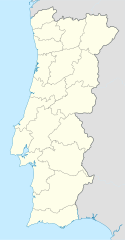
Deutsch: Positionskarte von Portugal
Quadratische Plattkarte, N-S-Streckung 130 %. Geographische Begrenzung der Karte:
English: Location map of Portugal
Equirectangular projection, N/S stretching 130 %. Geographic limits of the map:
Español: Mapa de Portugal con los 18 distritos delimitados
Proyección cilíndrica equidistante, N/S alargamiento 130 %. Límites geográficos del mapa:
Português: Mapa de Portugal com os 18 distritos delimitados, para uso em localizações geográficas
Projecção cilíndrica equidistante, N/S alongamento 130 %. Limites geográficos do mapa:
|
| Siku | 03-07-2008 |
| Ukaboni | own work, using United States National Imagery and Mapping Agency data |
| Mlembi | NordNordWest |
| Other versions |
Derivative works of this file: |

|
This map has been made or improved in the German Kartenwerkstatt (Map Lab). You can propose maps to improve as well.
|
Chilolezo
I, the copyright holder of this work, hereby publish it under the following licenses:

|
Chilolezo ntchakupelekeka pakupanga copy, kutandazga panj kusintha na malango gha GNU Free Documentation License, Version 1.2 or any later version published by the Free Software Foundation; with no Invariant Sections, no Front-Cover Texts, and no Back-Cover Texts. A copy of the license is included in the section entitled GNU Free Documentation License. |
Chinthu ichi ntchakuzomelezgeka na Creative Commons Attribution-Share Alike 3.0 Unported license.
- Ndimwe ŵakuzomelezgeka:
- kugaŵa – kuti mutandazge, kugaŵa na kusintha ntchito
- kusazga – kusintha chito iyi
- Pa malango ghakulondezga agha:
- Viyambilo vya kuchita – Mukwenela kupeleka malumbo ghawemi, kupeleka linki yakutyonda ku chilolezo, kweneso yowoyaniso pala vinyake vyasintha. Mukwenela kuchita nthena mwakwenelela, kwambula kujikhalila khonde.
- mwa kugaŵana – Pala mwasazga panji mwasintha chinthu, mukwenela kuchitandazga
You may select the license of your choice.
Mbili ya chinthu
Dofyani pa siku/nyengo kuti muone umo vikaonekela pa nyengo iyo.
| Siku/Nyengo | Kachithuzi | Vipimo | Mgwiliski | Ganizo | |
|---|---|---|---|---|---|
| sono | 08:27, 29 Ogasiti 2008 | | 612 × 1,173 (211 KB) | NordNordWest | |
| 18:29, 11 Ogasiti 2008 |  | 306 × 586 (207 KB) | NordNordWest | ||
| 22:01, 2 Julayi 2008 |  | 306 × 586 (236 KB) | NordNordWest | {{Information |Description= {{de|Positionskarte von Portugal}} Quadratische Plattkarte, N-S-Streckung 130 %. Geographische Begrenzung der Karte: * N: 42.3° N * S: 36.7° N * W: 9.8° W * O: 6.0° W {{en|Location map of [[:en:Portugal|Por |
Magwiliskilo ntchito
The following 2 pages use this file:
Umo chinthu chagwiliskikila ntchito
Ma wiki ghanyake agho ghakugwiliska ichi:
- Magwiliskilo pa af.wikipedia.org
- Magwiliskilo pa als.wikipedia.org
- Magwiliskilo pa am.wikipedia.org
- Magwiliskilo pa an.wikipedia.org
- Sacavém
- Lisbona
- Ericeira
- Mafra
- Sintra
- Braga
- Coimbra
- Évora
- Aveiro
- Guarda (Portugal)
- Leiria
- Setúbal
- Almada (Portugal)
- Miranda de l Douro
- Bumioso
- Sines
- Porto
- Estádio do Dragão
- Seu de Porto
- Cascais
- Guimarães
- Lousã
- Miranda do Corvo
- Pampilhosa da Serra
- Vila Nova de Gaia
- Pavilhão João Rocha
- Elvas
- Ponte de Sor
- Portalegre
- Plantilla:Mapa de localización Portugal
- Magwiliskilo pa ar.wikipedia.org
- Magwiliskilo pa az.wikipedia.org
Wonani magwiliskilo ghanandi ghapa charu gha chinthu ichi.