File:SUR orthographic.svg

Size of this PNG preview of this SVG file: 550 × 550 pixels. Mu misani inyake: 240 × 240 pixels | 480 × 480 pixels | 768 × 768 pixels | 1,024 × 1,024 pixels | 2,048 × 2,048 pixels.
Chinthu cha kwenekuko (SVG file, nominally 550 × 550 pixels, file size: 1.11 MB)
Mwakudumula
| Malongosolelo |
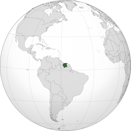
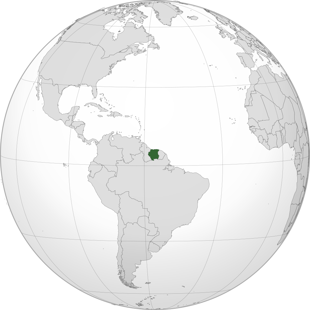
English: Orthographic map of Suriname centered at 4° N, 56° W.
Official territory.
Claimed territories. |
| Siku | |
| Ukaboni | Chinthu chane |
| Mlembi | Addicted04 |
| SVG genesis |
Chilolezo
I, the copyright holder of this work, hereby publish it under the following license:
Chinthu ichi ntchakuzomelezgeka na Creative Commons Attribution-Share Alike 3.0 Unported license.
- Ndimwe ŵakuzomelezgeka:
- kugaŵa – kuti mutandazge, kugaŵa na kusintha ntchito
- kusazga – kusintha chito iyi
- Pa malango ghakulondezga agha:
- Viyambilo vya kuchita – Mukwenela kupeleka malumbo ghawemi, kupeleka linki yakutyonda ku chilolezo, kweneso yowoyaniso pala vinyake vyasintha. Mukwenela kuchita nthena mwakwenelela, kwambula kujikhalila khonde.
- mwa kugaŵana – Pala mwasazga panji mwasintha chinthu, mukwenela kuchitandazga
Mbili ya chinthu
Dofyani pa siku/nyengo kuti muone umo vikaonekela pa nyengo iyo.
| Siku/Nyengo | Kachithuzi | Vipimo | Mgwiliski | Ganizo | |
|---|---|---|---|---|---|
| sono | 15:16, 8 Meyi 2023 | | 550 × 550 (1.11 MB) | WeaponizingArchitecture | Stop it please. |
| 22:38, 6 Meyi 2023 |  | 512 × 512 (903 KB) | SurinameCentral | Reverted to version as of 17:32, 7 April 2023 (UTC) | |
| 00:45, 5 Meyi 2023 |  | 550 × 550 (1.11 MB) | WeaponizingArchitecture | Stop adding in surinames disputes. It does not goven this land | |
| 17:32, 7 Epulelo 2023 |  | 512 × 512 (903 KB) | SurinameCentral | Reverted to version as of 13:41, 26 March 2023 (UTC), This image is being used on a Suriname Specific Page. | |
| 16:35, 7 Epulelo 2023 |  | 550 × 550 (1.11 MB) | Kordas | Tigri Area is not Suriname | |
| 13:41, 26 Malichi 2023 |  | 512 × 512 (903 KB) | SurinameCentral | Background Transparency Corrected | |
| 23:31, 24 Malichi 2023 |  | 512 × 512 (872 KB) | SurinameCentral | Suriname Highlight corrections | |
| 20:06, 8 Julayi 2012 |  | 550 × 550 (1.11 MB) | Addicted04 |
Magwiliskilo ntchito
The following page uses this file:
Umo chinthu chagwiliskikila ntchito
Ma wiki ghanyake agho ghakugwiliska ichi:
- Magwiliskilo pa ar.wikipedia.org
- مستخدم:جار الله/قائمة صور مقالات العلاقات الثنائية
- العلاقات الأمريكية السورينامية
- العلاقات الأنغولية السورينامية
- العلاقات السورينامية الكورية الجنوبية
- العلاقات الإريترية السورينامية
- العلاقات السورينامية السويسرية
- العلاقات الألمانية السورينامية
- العلاقات السورينامية الليختنشتانية
- العلاقات البوليفية السورينامية
- العلاقات السورينامية الموزمبيقية
- العلاقات الألبانية السورينامية
- العلاقات البلجيكية السورينامية
- العلاقات الإثيوبية السورينامية
- العلاقات البيلاروسية السورينامية
- العلاقات السورينامية الطاجيكستانية
- العلاقات الروسية السورينامية
- العلاقات الرومانية السورينامية
- العلاقات الأرجنتينية السورينامية
- العلاقات السورينامية الغامبية
- العلاقات السورينامية القبرصية
- العلاقات السورينامية السيراليونية
- العلاقات السورينامية النيبالية
- العلاقات السورينامية الليبيرية
- العلاقات التشيكية السورينامية
- العلاقات السورينامية الميانمارية
- العلاقات السورينامية الكندية
- العلاقات السعودية السورينامية
- العلاقات الزيمبابوية السورينامية
- العلاقات الإسرائيلية السورينامية
- العلاقات البالاوية السورينامية
- العلاقات السورينامية المالية
- العلاقات السورينامية النيجيرية
- العلاقات اليمنية السورينامية
- العلاقات السورينامية الفانواتية
- العلاقات الغابونية السورينامية
- العلاقات البنمية السورينامية
- العلاقات السورينامية الكوبية
- العلاقات الجورجية السورينامية
- العلاقات التونسية السورينامية
- العلاقات السورينامية الكورية الشمالية
- العلاقات الهندية السورينامية
- العلاقات اليابانية السورينامية
- العلاقات الإيطالية السورينامية
- العلاقات السورينامية الناوروية
- العلاقات الأسترالية السورينامية
- العلاقات الزامبية السورينامية
- العلاقات السورينامية الفيجية
- العلاقات المارشالية السورينامية
- العلاقات الأذربيجانية السورينامية
- العلاقات السودانية السورينامية
Wonani magwiliskilo ghanandi ghapa charu gha chinthu ichi.