File:The Philippines and ASEAN (orthographic projection).svg

Size of this PNG preview of this SVG file: 550 × 551 pixels. Mu misani inyake: 240 × 240 pixels | 479 × 480 pixels | 767 × 768 pixels | 1,022 × 1,024 pixels | 2,044 × 2,048 pixels.
Chinthu cha kwenekuko (SVG file, nominally 550 × 551 pixels, file size: 449 KB)
Mwakudumula
| Malongosolelo |
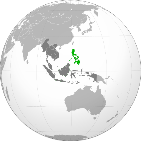
English: Orthographic projection of The Philippines, with ASEAN states highlighted. |
| Ukaboni | Chinthu chane |
| Mlembi | Connormah |
| Other versions |
.svg) |
.svg)
.svg)
.svg)
.svg)
.svg)
.svg)
.svg)
.svg)
.svg)
.svg)
.svg)
.svg)
.svg)
.svg)
.svg)
.svg)
.svg)
.svg)
.svg)
.svg)
.svg)
.svg)
.svg)
.svg)
.svg)
.svg)
.svg)
.svg)
.svg)
.svg)
.svg)
.svg)
.svg)
.svg)
.svg)
.svg)
.svg)
.svg)
.svg)
.svg)
.svg)
.svg)
.svg)
.svg)
.svg)
.svg)
.svg)
.svg)
.svg)
.svg)
.svg)
.svg)
.svg)
.svg)
.svg)
.svg)
.svg)
.svg)
.svg)
.svg)
.svg)
.svg)
.svg)
.svg)
.svg)
.svg)
.svg)
.svg)
.svg)
.svg)
.svg)
.svg)
.svg)

.svg)

.svg)

.svg)
.svg)
.svg)
.svg)
.svg)
.svg)
.svg)


.svg)
.svg)
.svg)
.svg)
.svg)
.svg)
.svg)

.svg)
.svg)
.svg)
.svg)
.svg)
.svg)
.svg)
.svg)
.svg)

.svg)
.svg)
.svg)
.svg)
.svg)
.svg)
.svg)
_without_national_boundaries.svg)
.svg)
.svg)
.svg)
.svg)
.svg)
.svg)

.svg)
.svg)
.png)
.svg)
.svg)
.svg)
.svg)

.svg)
.svg)
.svg)
.svg)
.svg)
.svg)
.svg)
.svg)
.svg)
.svg)
.svg)

.svg)
.svg)
.svg)
.svg)
.svg)
.svg)
.svg)
.svg)
.svg)

.svg)
.svg)

.svg)
.svg)
.svg)
.svg)
.svg)
.svg)
.svg)
.svg)
.svg)
.svg)
.svg)
.svg)
.svg)
.svg)
.svg)
.svg)
.svg)
.svg)
.svg)
.svg)
.svg)
.svg)
.svg)
.svg)
.svg)
.svg)
.svg)
_-_Crimea_disputed.svg)
.svg)
.svg)
.svg)
.svg)
.svg)
.svg)
.svg)
.svg)
.svg)
.svg)
.svg)
_political.svg)
.svg)
.svg)
.svg)
.svg)
_-_Crimea_disputed_-_no_borders.svg)
.svg)
.svg)
.svg)
.svg)
.svg)
.svg)
.svg)
.svg)
.svg)
.svg)
.svg)

.svg)
.svg)
.svg)

.png)
.svg)
.svg)
.svg)
.svg)
.svg)
.svg)
.svg)
.svg)
.svg)
.svg)
.svg)
.svg)
.svg)
.svg)
.svg)
.svg)
.svg)
.svg)
.svg)
.svg)
.svg)
.svg)
.svg)
.svg)
.svg)
.svg)
.svg)
.svg)
.svg)
.svg)
.svg)
.svg)
.svg)
.svg)
.png)
.svg)
.svg)
.svg)
_(orthographic_projection).png)
.svg)
.svg)
.svg)
.svg)
.svg)
Chilolezo
I, the copyright holder of this work, hereby publish it under the following licenses:
Chinthu ichi ntchakuzomelezgeka na Creative Commons Attribution-Share Alike 3.0 Unported license.
- Ndimwe ŵakuzomelezgeka:
- kugaŵa – kuti mutandazge, kugaŵa na kusintha ntchito
- kusazga – kusintha chito iyi
- Pa malango ghakulondezga agha:
- Viyambilo vya kuchita – Mukwenela kupeleka malumbo ghawemi, kupeleka linki yakutyonda ku chilolezo, kweneso yowoyaniso pala vinyake vyasintha. Mukwenela kuchita nthena mwakwenelela, kwambula kujikhalila khonde.
- mwa kugaŵana – Pala mwasazga panji mwasintha chinthu, mukwenela kuchitandazga

|
Chilolezo ntchakupelekeka pakupanga copy, kutandazga panj kusintha na malango gha GNU Free Documentation License, Version 1.2 or any later version published by the Free Software Foundation; with no Invariant Sections, no Front-Cover Texts, and no Back-Cover Texts. A copy of the license is included in the section entitled GNU Free Documentation License. |
You may select the license of your choice.
Mbili ya chinthu
Dofyani pa siku/nyengo kuti muone umo vikaonekela pa nyengo iyo.
| Siku/Nyengo | Kachithuzi | Vipimo | Mgwiliski | Ganizo | |
|---|---|---|---|---|---|
| sono | 19:22, 28 Febuluwale 2011 | | 550 × 551 (449 KB) | Midnight Stranger | Undo colorization |
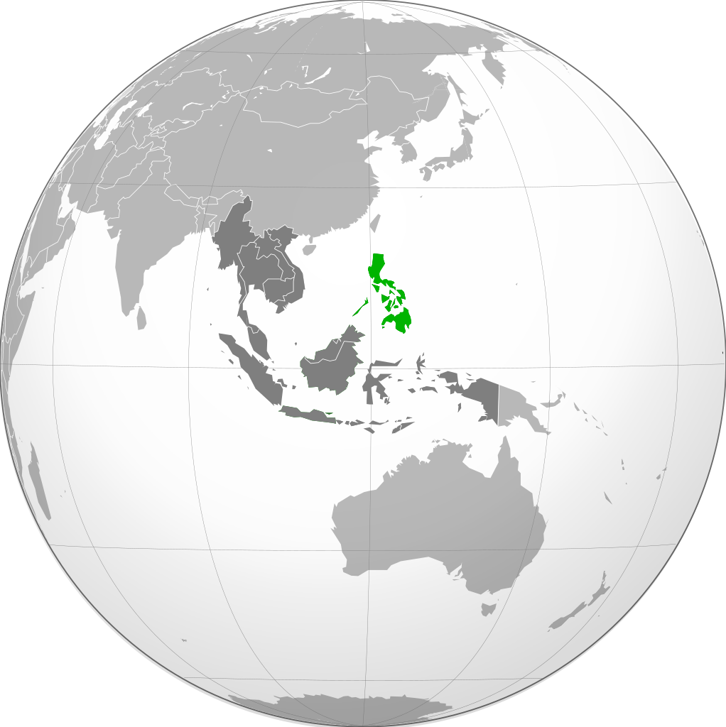
| 19:17, 28 Febuluwale 2011 |  | 550 × 551 (781 KB) | Midnight Stranger | Colorized | |
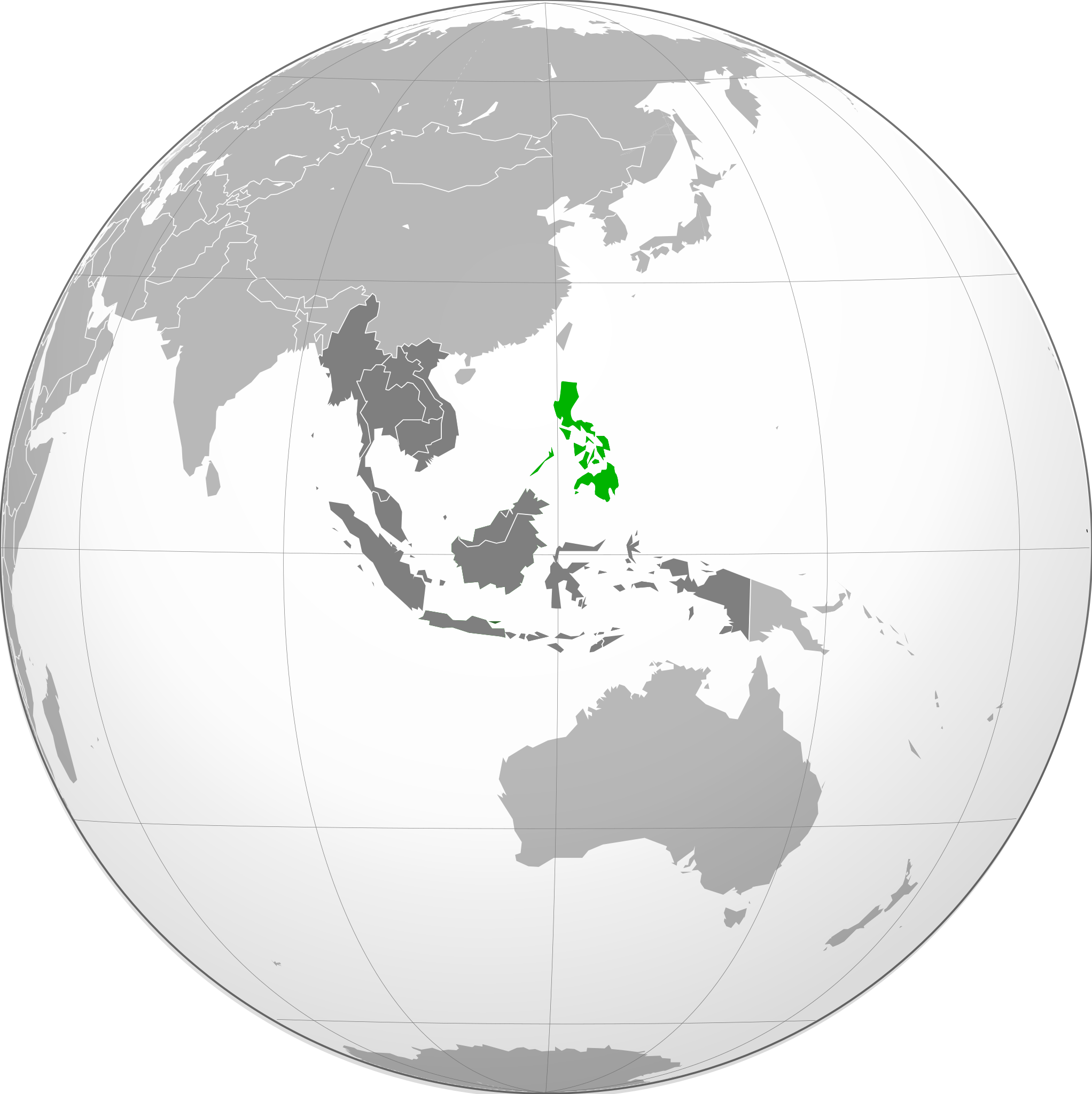
| 06:03, 19 Malichi 2010 |  | 550 × 551 (449 KB) | Lambanog | Increased contrast to make country more easily identifiable. | |
| 05:35, 19 Malichi 2010 |  | 550 × 551 (421 KB) | Lambanog | Increased contrast to make identification of the country easier. | |
| 00:13, 21 Febuluwale 2010 |  | 550 × 551 (413 KB) | Connormah | Reverted to version as of 01:29, 16 January 2010 keep consistent w/ other orthographic maps | |
| 20:58, 20 Febuluwale 2010 |  | 550 × 551 (420 KB) | Lambanog | Lightened green used in picture to increase contrast between green and grey colors. | |
| 01:29, 16 Janyuwale 2010 |  | 550 × 551 (413 KB) | Connormah | {{Information |Description={{en|1=Orthographic projection of The Philippines, with ASEAN states highlighted.}} |Source={{own}} |Author=Connormah |Date= |Permission= |other_versions={{User:Heraldry/Projections}} }} |
Magwiliskilo ntchito
The following page uses this file:
Umo chinthu chagwiliskikila ntchito
Ma wiki ghanyake agho ghakugwiliska ichi:
- Magwiliskilo pa ace.wikipedia.org
- Magwiliskilo pa ang.wikipedia.org
- Magwiliskilo pa arc.wikipedia.org
- Magwiliskilo pa ar.wikipedia.org
- Magwiliskilo pa az.wiktionary.org
- Magwiliskilo pa ba.wikipedia.org
- Magwiliskilo pa bn.wikipedia.org
- Magwiliskilo pa ckb.wikipedia.org
- Magwiliskilo pa csb.wikipedia.org
- Magwiliskilo pa cs.wikipedia.org
- Magwiliskilo pa de.wikipedia.org
- Magwiliskilo pa fa.wikipedia.org
- Magwiliskilo pa he.wikipedia.org
- Magwiliskilo pa ilo.wikipedia.org
- Magwiliskilo pa incubator.wikimedia.org
- Magwiliskilo pa io.wikipedia.org
- Magwiliskilo pa it.wikipedia.org
- Magwiliskilo pa ja.wikipedia.org
- Magwiliskilo pa ka.wikipedia.org
- Magwiliskilo pa kbd.wikipedia.org
- Magwiliskilo pa ko.wikipedia.org
- Magwiliskilo pa krc.wikipedia.org
- Magwiliskilo pa la.wikipedia.org
- Magwiliskilo pa mrj.wikipedia.org
- Magwiliskilo pa mr.wikipedia.org
- Magwiliskilo pa ne.wikipedia.org
- Magwiliskilo pa pa.wikipedia.org
- Magwiliskilo pa pl.wiktionary.org
- Magwiliskilo pa pnb.wikipedia.org
- Magwiliskilo pa rw.wikipedia.org
- Magwiliskilo pa sah.wikipedia.org
- Magwiliskilo pa sat.wikipedia.org
- Magwiliskilo pa sa.wikipedia.org
- Magwiliskilo pa si.wikipedia.org
- Magwiliskilo pa sq.wikinews.org
- Magwiliskilo pa ss.wikipedia.org
- Magwiliskilo pa ta.wikipedia.org
- Magwiliskilo pa tr.wikipedia.org
- Magwiliskilo pa war.wikipedia.org
Wonani magwiliskilo ghanandi ghapa charu gha chinthu ichi.
.svg)
.svg)