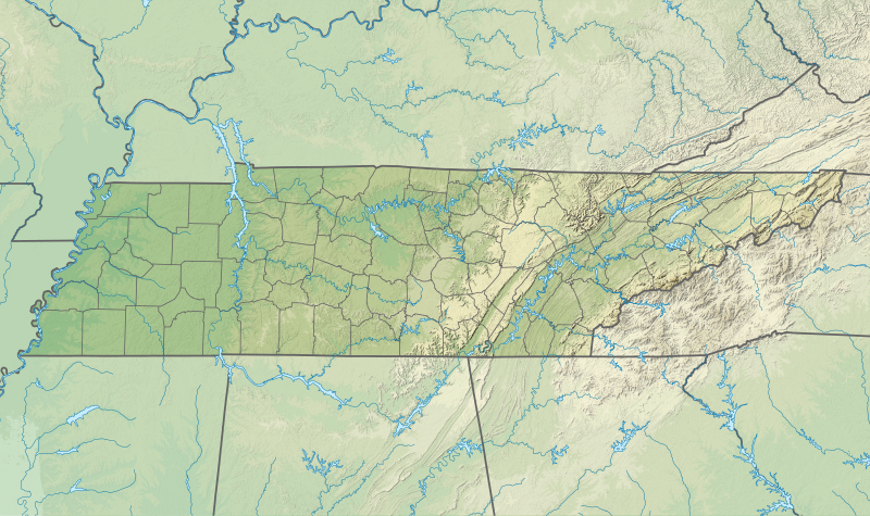
File:USA Tennessee relief location map.svg

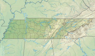
Size of this PNG preview of this SVG file: 800 × 475 pixels. Mu misani inyake: 320 × 190 pixels | 640 × 380 pixels | 1,024 × 608 pixels | 1,280 × 759 pixels | 2,560 × 1,519 pixels | 1,800 × 1,068 pixels.
Chinthu cha kwenekuko (SVG file, nominally 1,800 × 1,068 pixels, file size: 4.1 MB)
Mwakudumula
| Malongosolelo | |
| Siku | |
| Ukaboni |
Chinthu chane
|
| Mlembi | SANtosito |
| Other versions |
 |
Chilolezo
I, the copyright holder of this work, hereby publish it under the following license:
This file is licensed under the Creative Commons Attribution-Share Alike 4.0 International license.
- Ndimwe ŵakuzomelezgeka:
- kugaŵa – kuti mutandazge, kugaŵa na kusintha ntchito
- kusazga – kusintha chito iyi
- Pa malango ghakulondezga agha:
- Viyambilo vya kuchita – Mukwenela kupeleka malumbo ghawemi, kupeleka linki yakutyonda ku chilolezo, kweneso yowoyaniso pala vinyake vyasintha. Mukwenela kuchita nthena mwakwenelela, kwambula kujikhalila khonde.
- mwa kugaŵana – Pala mwasazga panji mwasintha chinthu, mukwenela kuchitandazga
Mbili ya chinthu
Dofyani pa siku/nyengo kuti muone umo vikaonekela pa nyengo iyo.
| Siku/Nyengo | Kachithuzi | Vipimo | Mgwiliski | Ganizo | |
|---|---|---|---|---|---|
| sono | 03:39, 4 Febuluwale 2021 | | 1,800 × 1,068 (4.1 MB) | SANtosito | Uploaded own work with UploadWizard |
Magwiliskilo ntchito
The following page uses this file:
Umo chinthu chagwiliskikila ntchito
Ma wiki ghanyake agho ghakugwiliska ichi:
- Magwiliskilo pa bg.wikipedia.org
- Magwiliskilo pa ca.wikipedia.org
- Magwiliskilo pa ckb.wikipedia.org
- Magwiliskilo pa de.wikipedia.org
- WIMZ-FM-Sendemast
- Tennessee Valley Authority
- Roan Mountain
- Vorlage:Positionskarte USA Tennessee
- WEVL
- Lookout Mountain
- Raccoon-Mountain-Pumpspeicherwerk
- Clingmans Dome
- Island F
- WSAA
- WZNG
- Boone Lake (South Fork Holston River)
- Watauga Lake
- Cherokee Lake (Holston River)
- Norris Lake
- Wilbur Lake (Tennessee)
- Montgomery Bell’s Tunnel
- Mount Le Conte (Tennessee)
- Magwiliskilo pa en.wikipedia.org
Wonani magwiliskilo ghanandi ghapa charu gha chinthu ichi.