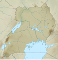
File:Uganda relief map.svg

Size of this PNG preview of this SVG file: 589 × 599 pixels. Mu misani inyake: 236 × 240 pixels | 472 × 480 pixels | 755 × 768 pixels | 1,007 × 1,024 pixels | 2,013 × 2,048 pixels | 1,441 × 1,466 pixels.
Chinthu cha kwenekuko (SVG file, nominally 1,441 × 1,466 pixels, file size: 1.89 MB)
Mbili ya chinthu
Dofyani pa siku/nyengo kuti muone umo vikaonekela pa nyengo iyo.
| Siku/Nyengo | Kachithuzi | Vipimo | Mgwiliski | Ganizo | |
|---|---|---|---|---|---|
| sono | 04:47, 22 Novembala 2020 |  | 1,441 × 1,466 (1.89 MB) | C1MM | Uploaded a work by Own work based on User:NordNordWest from Derivative of File:Uganda adm location map.svg with UploadWizard |
Magwiliskilo ntchito
The following 2 pages use this file:
Umo chinthu chagwiliskikila ntchito
Ma wiki ghanyake agho ghakugwiliska ichi:
- Magwiliskilo pa bg.wikipedia.org
- Magwiliskilo pa en.wikipedia.org
- Kampala
- Rwenzori Mountains
- Lake Albert (Africa)
- Lake Kyoga
- Mount Elgon
- Lake Edward
- Virunga Mountains
- Mount Stanley
- Lake George (Uganda)
- Murchison Falls
- Queen Elizabeth National Park
- Lake Bunyonyi
- Mount Moroto
- Rwenzori Mountains National Park
- Mount Muhabura
- Mgahinga Gorilla National Park
- Mount Gahinga
- Lake Mburo National Park
- Mount Kadam
- Mount Speke
- Mount Baker (Uganda)
- Mount Morungole
- Mount Zulia
- Lake Kwania
- Arua Airport
- Mount Sabyinyo
- Nyero rock paintings
- Tororo Rock
- Lake Nabugabo
- Lake Wamala
- Katonga Wildlife Reserve
- Kidepo Airport
- Jinja Airport
- Kakira Airport
- Adjumani Airport
- Kabale Airport
- Lake Mutanda
Wonani magwiliskilo ghanandi ghapa charu gha chinthu ichi.